Sokkia
Software
Sokkia Field
Intuitive field software for collecting, laying out and managing survey points with Sokkia instruments.
Available through
Surveying Systems Tunisia
Authorised Topcon & Sokkia Distributor
Product Overview
Professional surveying performance.
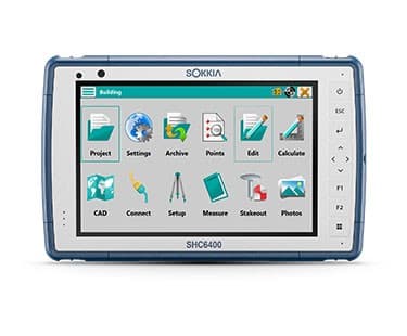
Sokkia Field provides a straightforward graphical environment for professional field surveying. It enables users to collect and lay out points, control compatible Sokkia GNSS and robotic systems, work with CAD information in the field and export point data for use in third-party software.
Key Features
Product highlights
Graphical Windows tablet interface
Field measurement collection
Point layout workflows
Sokkia GNSS system control
Sokkia robotic instrument control
CAD functionality in the field
Point-file export to third-party software
Technical Specifications
Technical details
Applications
Built for professional workflows.
Documents
Product Brochures
View the available manufacturer documentation for this product.
Sokkia Field Brochure
Interested in this product?